Map Reading For Hikers: A Complete Beginner Guide That Actually Makes Sense
Author:Mike Fakunle
|
Released:October 3, 2025
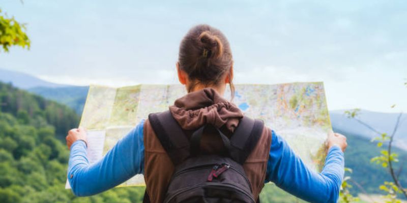
Map reading for hikers is one of the most important outdoor skills to learn early. A map shows where the trail goes, how steep the land is, and what lies ahead long before it appears on the path.
Many beginners feel confused by lines, symbols, and scales. That confusion fades fast when each part is explained clearly and practically. This guide walks through everything needed to read hiking maps with confidence, even on a first trip.
Why Map Reading For Hikers Still Matters Today
Phones run out of battery, lose signal, or fail in cold weather. Map reading for hikers works anywhere and never shuts off. A paper map also shows the bigger picture, not just a moving dot.

Strong hiking navigation skills help avoid wrong turns, wasted energy, and unsafe terrain. Knowing how to read a map builds calm decision-making and reduces panic when trails are unclear.
Understanding The Types Of Maps Used For Hiking
Not all maps are made for walking through wild areas. Knowing which map to use makes hiking navigation much easier.
Topographic Maps And Why Hikers Rely On Them
Topographic maps show land shape using contour lines. These lines reveal hills, valleys, ridges, and flat areas. Map reading for hikers depends heavily on this detail because it explains how hard a hike will feel.
These maps often come from carefully measured land surveys, and many public versions are based on long-standing mapping standards used worldwide.
Trail Maps Versus Topographic Maps Explained Clearly
Trail maps focus on routes and landmarks but often skip elevation detail. Topographic maps go deeper by showing terrain shape. Using both together improves hiking navigation and planning accuracy.
What Map Scale Means And How To Choose The Right One
The map scale shows how much real ground fits on the map. A smaller scale covers more land with less detail. Beginners should choose a scale that balances clear trails with readable terrain features.
When To Use Printed Maps Versus Offline Digital Maps
Printed maps never fail and show the full area at once. Offline maps on phones can help confirm location. Using both supports safer map reading for hikers.
How To Read A Topographic Map Step By Step
Topographic maps can look busy, but each feature follows a simple system that becomes familiar with practice.
Identifying Map Orientation, North, And Grid Lines
Maps are usually oriented with north at the top. Grid lines help measure distance and direction. Aligning the map correctly is the first step in hiking navigation.
Understanding Contour Lines And Elevation Changes
Contour lines connect points of equal height. Lines close together mean steep slopes. Wide spacing means gentle ground. Reading these lines helps predict effort and time.
Recognizing Terrain Features Such As Ridges, Valleys, And Saddles
U-shaped lines point uphill in valleys and downhill on ridges. Saddles appear as low points between peaks. These shapes are essential for accurate map reading for hikers.
Interpreting Map Symbols For Trails, Water, Roads, And Landmarks
Colors and shapes represent features like rivers, paths, and buildings. Learning hiking map symbols prevents missed turns and wrong assumptions.
Learning Map Symbols Every Beginner Hiker Must Know
Hiking map symbols follow standard rules that stay consistent across regions.
Trail Markings And Route Indicators
Dashed lines often mark footpaths. Solid lines may show roads. Route numbers help confirm position during hiking navigation.

Water Sources, Shelters, And Campsites
Blue shapes show water. Small icons mark shelters or camps. These details help plan breaks and overnight stops.
Roads, Boundaries, And Restricted Areas
Thicker lines indicate major roads. Boundaries may limit access. Reading these symbols protects safety and legality.
Man-Made Versus Natural Feature Symbols
Squares and straight edges usually show human features. Curved shapes represent nature. This distinction matters during map reading for hikers.
How To Use A Compass With A Map For Hiking
Compass navigation works best when paired with a map.
Understanding Compass Parts And Basic Functions
A compass has a needle, housing, and direction markings. Each part helps maintain accurate hiking navigation.
Aligning A Map With A Compass Correctly
Placing the compass along the north lines aligns the map to the land. This step connects paper to reality.
Taking And Following A Bearing Safely
A bearing shows the direction to travel. Following it helps stay on course when trails fade.
Common Compass Mistakes Beginners Make
Forgetting magnetic differences or misreading degrees can lead off course. Careful checks prevent errors.
How To Orient Yourself On The Trail Using A Map
Orientation means knowing where you are without guessing.
Matching Map Features With Real-World Landmarks
Hills, streams, and junctions confirm location. This habit strengthens map reading for hikers.
Using Terrain Shapes To Confirm Location
Slope direction and elevation help verify position even without clear paths.
Estimating Distance Traveled Using Map Scale
Measuring distance helps track progress and manage energy.
Staying Found Instead Of Trying To Reorient After Getting Lost
Regular checks reduce the chance of confusion during hiking navigation.
Reading Elevation And Terrain To Plan Better Hikes
Good planning starts before stepping onto the trail.
How To Identify Steep Climbs And Gentle Slopes
Tight contour lines signal hard climbs. This knowledge prevents surprises.
Spotting Potential Danger Zones On A Map
Cliffs, rivers, and exposed ridges appear clearly on topographic maps.
Choosing Routes Based On Fitness And Experience Level
Maps help match trail difficulty to ability.
Planning Rest Stops Using Terrain And Water Features
Water access and flat areas improve comfort and safety.
Common Map Reading Mistakes Beginners Make
Mistakes are common but easy to avoid.
Misreading Contour Spacing
Assuming equal effort across terrain leads to fatigue.
Ignoring Magnetic Declination
Declination shifts compass readings. Many mapping systems account for it, as explained across widely accepted land-measurement standards used by national land measurement systems.
Overestimating Hiking Speed And Distance
Maps show distance, not time. Terrain affects pace.
Failing To Update the Position During The Hike
Frequent checks keep hiking navigation accuracy.
How To Practice Map Reading Before Your First Real Hike
Practice builds skill faster than theory alone.
Practicing At Home Using Local Maps
Studying familiar areas improves recognition.
Using Parks Or Familiar Trails For Low-Risk Practice
Known terrain reduces pressure.
Combining Map Reading With GPS For Learning
GPS confirms guesses without replacing skills.
Building Confidence Gradually Instead Of All At Once
Short trips reinforce map reading for hikers.
What To Carry Alongside Your Hiking Map
Navigation works best with the right tools.
Choosing A Reliable Compass
A baseplate compass suits most beginners.
Protecting Maps From Weather Damage
Waterproof cases keep maps readable.
Backup Navigation Tools For Emergencies
Extra tools support hiking navigation when conditions change.
Keeping Navigation Gear Accessible On The Trail
Easy access encourages frequent checks.
When Map Reading Skills Can Save Your Hike
Real situations test preparation.
Handling Missed Turns And Unclear Trail Junctions
Maps reveal alternatives quickly.
Navigating When Trails Disappear Or Overlap
Terrain clues guide direction.
Adjusting Plans Due To Weather Or Terrain Changes
Maps show safer exit routes, supported by outdoor safety principles reflected across widely followed outdoor travel guidance.
Making Safe Exit Decisions Using Map Knowledge
Knowing options reduces risk.
Building Long-Term Confidence With Map Reading For Hikers
Skills grow with use and awareness.
How Skills Improve With Repetition And Observation
Patterns become familiar.
Knowing When To Trust The Map Over Assumptions
Maps stay objective.
Using Map Reading As Part Of Overall Hiking Safety
Navigation supports smart decisions, reinforced by gear knowledge commonly shared across trusted outdoor equipment standards.
Preparing For More Advanced Navigation Skills Over Time
Strong basics lead to advanced routes.
Why Map Reading For Hikers Is A Skill Worth Mastering
Map reading for hikers turns uncertainty into clarity. It supports safe hiking navigation, smarter planning, and calm decisions when conditions change. Learning topographic maps, hiking map symbols, and compass navigation builds confidence that lasts far beyond one trail.
Sources
Related Posts
Outdoor Gear
Backpacking Sleeping Bags for Warmth and Weight Savings

Activities
High-Altitude Adventure: Best Guided Trekking Tours In The Himalayas

Outdoor Gear
How to Use Trekking Poles: Techniques, Tips, and Terrain Adjustments
Outdoor Gear
Ultralight Backpacking Gear You Shouldn’t Skip In 2026

Guides and Tips
How To Choose The Perfect Backpack For Long Hikes Without Pain Or Regret
Guides and Tips